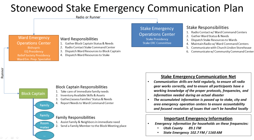
The Stonewood area consists of all households within the Stonewood Stake boundaries. These boundaries are between 400 South and 800 South, and between State Street and 400 West. Stonewood Stake is divided up into seven units, consisting of five wards and two branches. The wards and branches are subdivided into “blocks”. A block typically includes five to ten homes or apartments. Each of these geographical areas has emergency preparedness leaders assigned to the area.
One of the most important functions of emergency preparedness leaders is to communicate the status to city and area authorities, so that they can focus their efforts on doing the greatest good in the shortest amount of time as an emergency develops. The following diagram summarizes the emergency communication plan for the Stonewood Stake, and each part of the stake.
Click here to retrieve a PDF brochure for reference by CERT (Community Emergency Response Team) trained personnel:
CERT Brochure Link
